Want to ensure all your drone flights are safe and prevent hazards from happening? Or feeling tired of unwanted aerial visitors hovering over your backyard? Then keep reading this article!
We’ve rounded up the best drone detection apps for Android & iOS you could try. These apps help you detect, track, and even find the pilot of any drone in your area.
With just a few taps on your phone, you can detect nearby drone activity and take action if necessary. Plus, these apps cover some useful tools for pilots such as weather forecasts, wind speed, no-fly zones, and more. Let’s get into it!
Dronecast
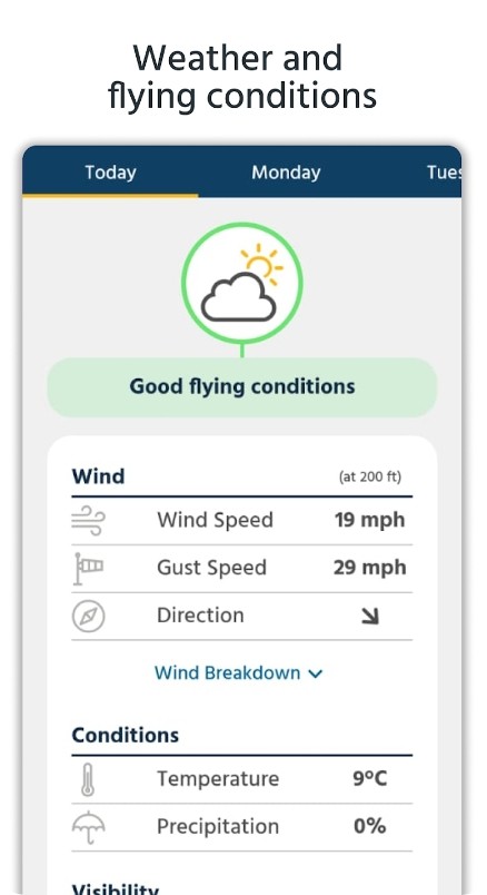
Let’s start with an app to cover all your flying needs. First off, this app is compatible with all drone models, so no worries here. The app provides all the info you need for a successful flying session. It covers up-to-date weather forecasts updated every minute.
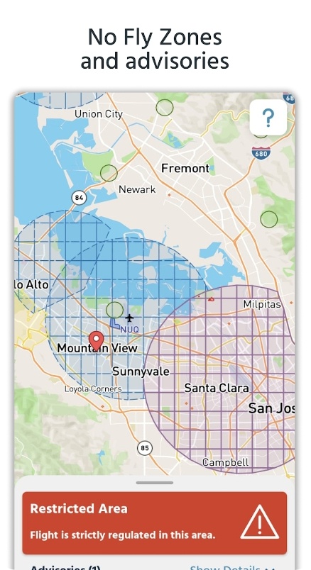
But safety first, right? The app helps to keep your drone safe by checking the wind and gust speeds before take-off at different altitudes. Besides, you can check if it’s safe to fly in your area with no-fly zones and advisories.
Hereby, you can also get accurate data for all major locations across the globe. Yup, no matter where your drone takes you, this app has got your back. The app is fully configurable, which means you can modify it to match your prefs. Plus, it’s completely ad-free.
Planning a flight? No worries: the app can make a pre-flight report, that lets you check weather conditions and potential hazards before take-off. And if you’re a true planner, you’ll love the 7-day forecast that gives a full hourly breakdown. Ideal for those long-term flying schedules.
You may also like: 8 Best Spy Camera Detector Apps
OpenSky
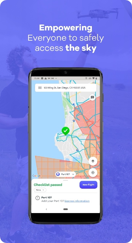
The main goal of this app is to let you fly your drone without worrying about breaking any regulations. It is like having a personal co-pilot sitting right next to you, guiding you every step of the way.
One of the coolest aspects of this one is the maps from the authorities. Regardless of if you’re using a drone for fun or commercial purposes, it makes it easy to picture all the rules. Thus, you’ll always know where you can and cannot fly, keeping you and others safe.
Above that, the app also helps to identify potential flight hazards in your area (aka temporary restrictions and all that). This is a game-changer for drone operators who want to fly without worrying about unknowingly entering restricted airspace.
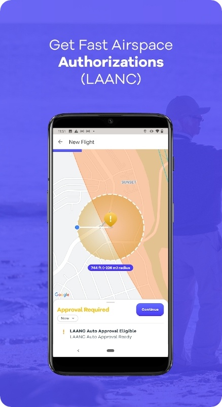
Plus, the app will track all of your past and upcoming flights, ensuring that you’re always in control and up-to-date on any changes or updates to your planned flights. You can also use it to request a flight in controlled airspace, it’s a lifesaver for all the big cities.
Drone Buddy
Have you ever been at the field ready to take off your drone, but suddenly, the weather changes, and you’re not sure if it’s safe to fly? This app is here to help! Not only does the app provide current wind speed, but also offers hourly and daily wind forecasts to help you plan your flights ahead of time.
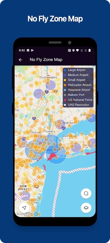
It also includes advanced weather and cloud ceiling info, which is vital for maintaining safe and legal flight conditions. Plus, there’s a full-on no-fly zone map. It shows areas where flying your drone is prohibited, which is extremely helpful for planning flights and avoiding potential legal issues.
The thing you’ll surely like about this one is color labeling. When conditions aren’t suitable for flying, the app clearly signals that with a red label. This will prevent you from making mistakes and help to stay safe while enjoying your hobby.
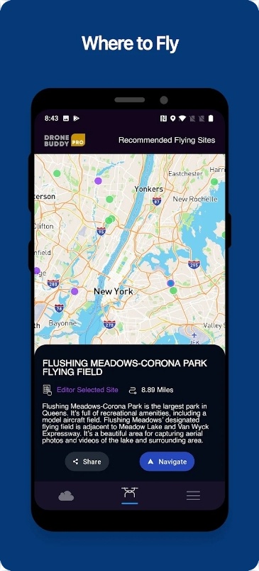
If you need to plan your flight in a specific location, you can easily search for it in the app, too. You can even adjust the map circle to show the distance you’re allowed to fly your drone.
Drone Scanner
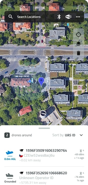
This app lets you monitor drone activity happening around you. It transforms your phone or tablet into a drone tracker in just a few clicks. You’ll get to browse a map and mark specific zones. This makes it easy to know where you can safely fly your own drone without interfering with nearby aircraft.
Furthermore, the map diligently keeps up with the latest regulations, guaranteeing that you are constantly equipped with the most up-to-date info. But the real magic happens when you discover more about the drones flying nearby in real time.
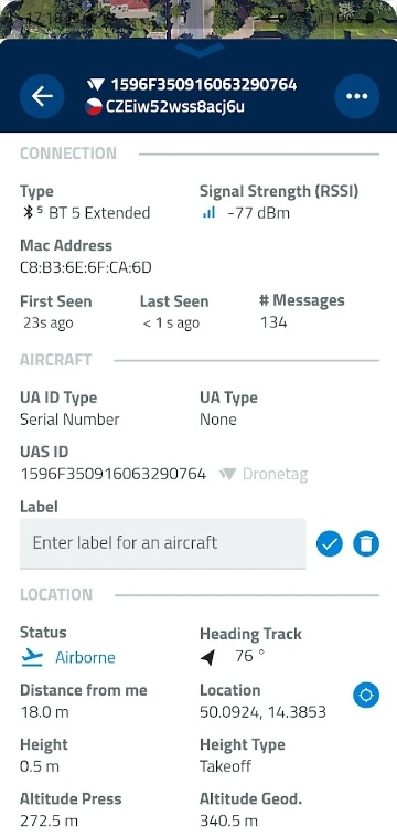
The app examines detailed info provided by drones via Bluetooth or Wi-Fi. It lets you view the height, direction, pilot, and location. You can indeed organize and use the data for other purposes, making you feel like a top-notch drone analyst.
And fear not, even if you’re not a tech whiz, using this app is as easy as pie. Anyone can quickly determine what drones are flying in the sky nearby. Whether you’re a hobbyist or just curious, this app has something for everyone.
Drone Assist
If you’re a drone enthusiast, or a professional pilot, who likes to fly safely and responsibly, you need to try this app. It’s like your personal drone weatherman, giving you all the info to ensure a safe and enjoyable flight.
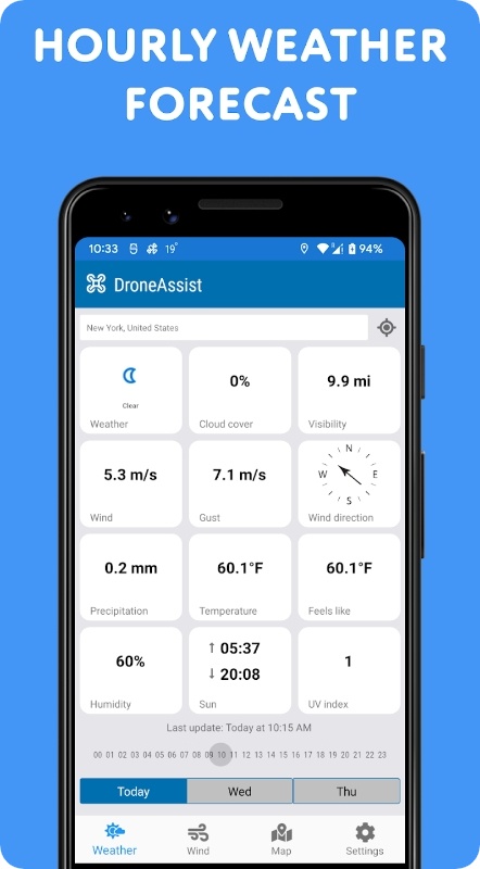
With this app, you no longer have to leave anything to chance. You’ll get a detailed weather forecast for your chosen area, which is updated hourly, and for up to 3 days in advance. The wind info is in-depth as well, the app covers speed, guts, direction, and all that. With all that at your disposal, you’ll navigate through any weather conditions like a champion.
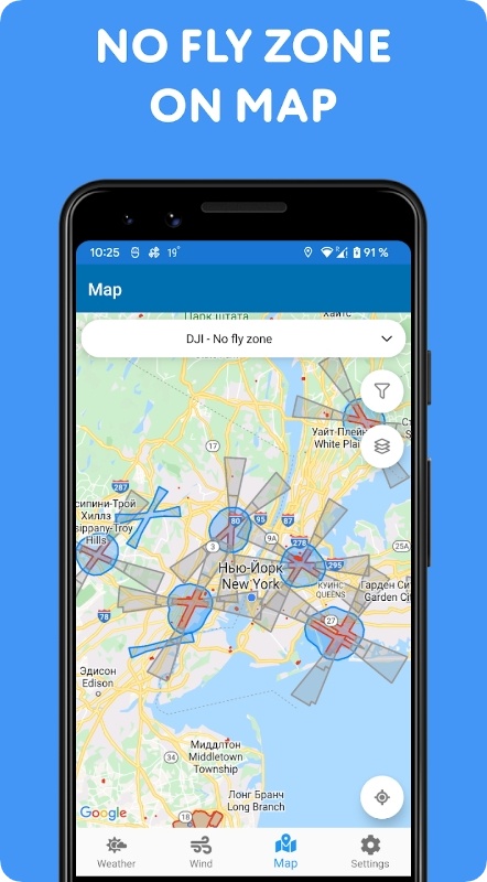
A no-fly air map is incredibly useful, too. It helps you easily identify which locations are safe to fly your drone, and which are not. You can quickly find out if there are any airports or other restricted areas nearby, and fly without worrying about breaking any laws.
Besides the standard temperature and humidity reports, this app also delivers dawn and dusk times, so you can plan your flights accordingly and capture the best shots at the right time. There’s even a built-in compass if needed.
Check also: 5 Best Fake Image Detector Apps
OpenDroneID
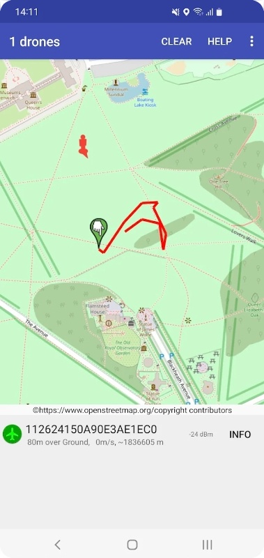
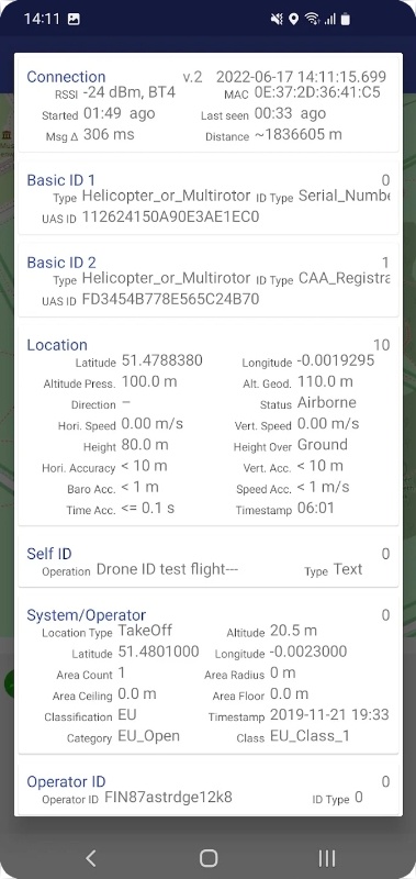
This nifty little app is like having your own personal air traffic control system for your drone. It lets you spot any droned flying around, and you won’t need to be a tech genius for that. This app is compliant with the latest Remote ID standards, making it one of the most reliable and accurate drone tracking tools available.
The coolest thing about this one is its ability to scan and identify drone signals not only by Bluetooth but also Wi-Fi. Thus, even if you’re not connected to any network, you’ll still be able to track nearby drones in real-time.
The application has an easy-to-understand display that shows the GPS of the drone on a map. It also delivers detailed info about the drone, including its model, serial number, and flight details. This makes it easier to determine a drone and ensure that only authorized ones get access to certain areas.
You can also use this app to check out allowed areas to ensure you’re always following all the rules. And all that won’t cost you a single dime. Cool, right?
Droneradar
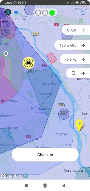
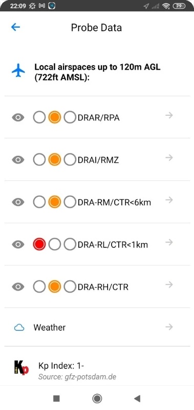
Tired of feeling lost in a sea of aviation rules? This app is here to help. It will guide you through the complicated maze of airspace restrictions. First off, it’s easy to use: you don’t need to do anything except for opening the app and looking at the map. The app uses color labels to mark different areas, so you’ll quickly figure out if you can fly here or not.
Green means you’re good to go (just pay attention to the height limits set on the app). Yellow means there are some restrictions in place, but don’t fret! Make sure to check the contact details for airspace managers. And if the light is red, sorry, but no flights are allowed.
But it’s not just about checking if you can fly. You can inform other space users of your flights (and monitor other pilots, too). Enter your contact details and the type of drone you’re operating, and your location will be marked on the map for the time indicated.
And if a flight plan is required for a particular location, you can use the app to log in for it. You’ll immediately get all the vital instructions.
B4UFLY
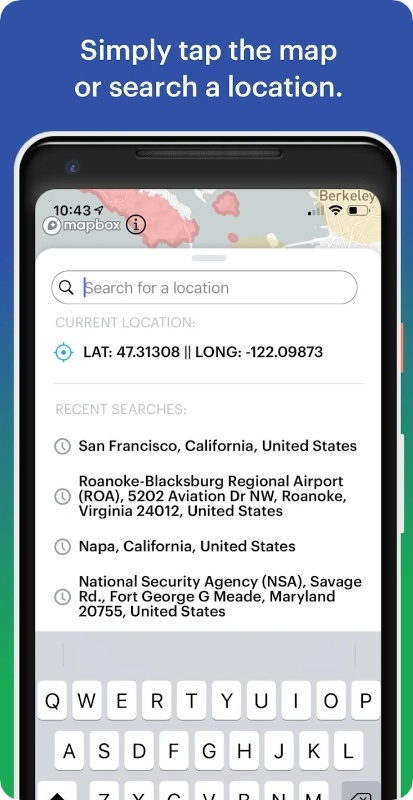
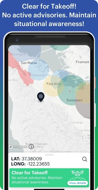
It’s a hassle-free way to ensure safe drone flying. This app is an ideal companion for any drone operator wanting to stay compliant and aware of airspace regulations. First off, it is incredibly user-friendly. Simply fire up the app and select a flight location to access all the details about the airspace in question.
You’ll be able to quickly view critical data about any advisories or restrictions in the area, providing peace of mind and keeping you on the right side of the law.
And that’s not all, it also comes loaded with exciting new crowdsourcing functionality! You can contribute your own local knowledge and compliance database, keeping your fellow drone enthusiasts safe and informed.
No more guessing or worrying about whether: the app covers in-depth forecasts along with the wind info. You can also easily flag areas for review and even submit new locations to be added to the app. The app is free, and there are no ads to interrupt your exp.
You may also check: 7 Free Hotspot Apps
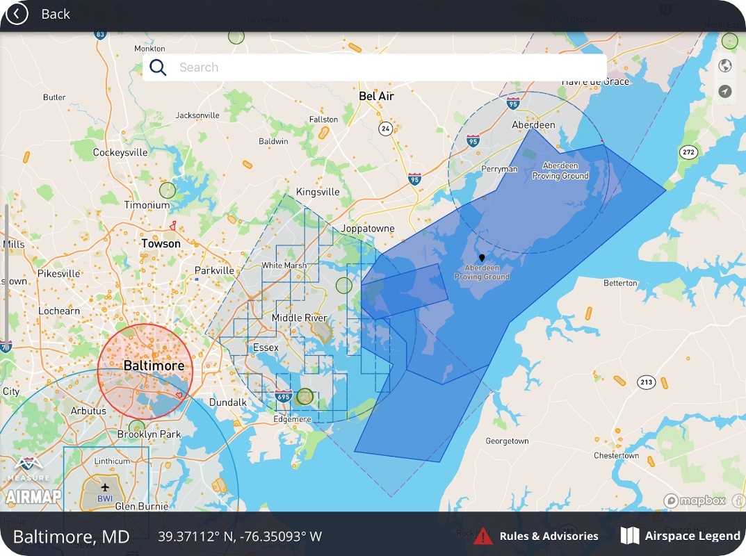
Measure Ground Control
And lastly, we have a one-stop app for managing your drone operations. With its manual flight mode and live streaming, you can easily keep an eye on your drone while flying it. The grid flight mode with terrain following is another unique tool that lets you obtain accurate data without any hassles.
Custom waypoint flight plans and mission building make it easier for you to alter your flight operations. The app also comes with a drone fleet and pilot management that lets you manage multiple drones and pilots easily.
Plus, the app covers custom flight safety checklists and lets users request authorization. You’ll get to schedule your missions and assign pilots as per requirements. And if you’re concerned about airspace and weather, the app has got you covered on that front too.
The app automatically uploads your flight logs and screen captures once you’ve completed your mission. It also covers a spectrum of active track modes if needed. And when it comes to data analysis, the app lets you proceed with imagery into high-quality data products.
